
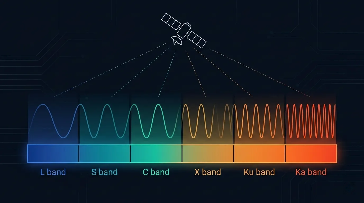
Satellite Frequency Bands: L, S, C, X, Ku and Ka
Understand L, S, C, X, Ku and Ka labels, ITU allocations, uplink/downlink direction, propagation, antenna scaling, and a defensible selection workflow.
What changed: Rebuilt the guide around the difference between letter-band nomenclature, ITU allocations, national authorization, and exact equipment ranges; replaced universal band claims with current ITU references, reproducible rain and aperture examples, and a deployment evidence workflow.
L, S, C, X, Ku, and Ka are useful engineering shorthand, but a letter is not a frequency assignment or permission to transmit. A defensible design records the exact frequency range, radio service, link direction, ITU Region and country, applicable footnotes, assignment or licence, network plan, and terminal capability.
Recommendation ITU-R V.431-9 explicitly warns that letter symbols can designate different frequency bands and that there is no standard correspondence. It advises stating the frequency limits or the reference that defines them. This single boundary prevents many procurement and link-budget errors.
Scope note: Organization fact check updated 27 August 2026 against the primary ITU sources listed on this page. The rain and antenna examples were independently recalculated. This is not a named spectrum-engineer approval, legal interpretation, frequency assignment, coordination result, terminal certification, operator approval, or availability guarantee. Confirm the current Radio Regulations, national table and authorization, operator plan, equipment documentation, and site-specific link analysis before deployment.
Link Budget Method | Rain-Fade Method | Ku vs Ka Procurement Questions
Quick Answer: A Band Label Is Not an Allocation
Use this evidence chain instead of selecting from a generic “band chart”:
usable satellite carrier
  = exact frequency limits
  + radio service and link direction
  + ITU Region, country and Article 5 footnotes
  + national assignment, licence or equivalent authorization
  + coordinated satellite-network and earth-station plan
  + compatible and approved terminal RF range
+ closed link budget and interference case| Question | Evidence that answers it |
|---|---|
| What does “Ku” or “Ka” mean here? | Stated lower and upper frequency limits plus the nomenclature source |
| May this link transmit? | ITU allocation context, national rules, assignment or licence, and operator authorization |
| Is it an uplink or downlink? | The applicable Earth-to-space or space-to-Earth allocation and network plan |
| Does the terminal tune to it? | Model-specific feed, filter, LNB/LNA, BUC/HPA, LO, polarization, waveform, and certification data |
| Is capacity or coverage available? | A dated operator beam, gateway, capacity, service-area, and contract record |
| Will the link meet availability? | A site-specific link budget and applicable ITU-R propagation models |
A letter alone does not establish orbit, coverage, throughput, terminal size, rain margin, availability, commercial access, or regulatory permission.
Keep Three Spectrum Layers Separate
1. Nomenclature
Names such as C band, Ku band, and Ka band are labels used by engineering communities, standards, manufacturers, and operators. The same label can cover different limits in radar, space communications, product marketing, or a particular network.
2. Allocation
The ITU Radio Regulations Table of Frequency Allocations divides spectrum by frequency, ITU Region, radio service, direction where applicable, allocation status, and footnotes. FSS, MSS, BSS, space operation, Earth exploration-satellite, radionavigation-satellite, and terrestrial services are different regulatory categories. A broad letter band can contain several of them.
An allocation is not a channel booking for a customer. It identifies how a frequency range may be used under the applicable regulatory framework.
3. Assignment and authorization
A frequency assignment, licence, class authorization, earth-station authorization, or equivalent national instrument applies the rules to an actual station or network. Satellite filings, coordination, operator access rules, and equipment conformity add separate conditions. The competent administration and operator—not a letter-band table—determine the usable carrier.
What the Letter Names Commonly Cover
The table below reproduces two different kinds of examples from Recommendation ITU-R V.431-9 Table 4. The middle column is a radar letter-band convention. The next column contains selected space-radiocommunication examples. Neither column is a complete Article 5 allocation table.
| Letter | Radar convention | Selected space-radiocommunication examples in V.431-9 | Do not infer |
|---|---|---|---|
| L | 1–2 GHz | 1.525–1.710 GHz | One continuous satellite allocation or universal MSS/GNSS access |
| S | 2–4 GHz | 2.500–2.690 GHz | That every frequency from 2–4 GHz is a satellite channel |
| C | 4–8 GHz | 3.4–4.2, 4.5–4.8 and 5.85–7.075 GHz | One global 4/6 GHz pair with identical regional rules |
| X | 8–12 GHz | No space example stated in this table | Government exclusivity, commercial availability, or a specific uplink/downlink pair |
| Ku | 12–18 GHz | 10.7–13.25 and 14.0–14.5 GHz | That all listed spectrum has the same service, direction, or national availability |
| K | 18–27 GHz | 17.7–20.2 GHz | A universal distinction between K and Ka product labels |
| Ka | 27–40 GHz | 27.5–30.0 GHz | That “Ka” means only 27–40 GHz in a complete satellite system |
V.431-9 also notes that K and Ka are frequently combined under Ka band for space radiocommunications. That is why equipment and network documents may call a roughly 20 GHz receive side and a roughly 30 GHz transmit side “Ka,” even though a generic radar chart places them in different letter bands. Always state the exact limits.
How to Read an Actual Allocation
For every proposed carrier, walk through the applicable frequency interval in Article 5 rather than stopping at the letter name:
- Record transmit and receive limits separately, including guard or exclusion ranges.
- Identify the intended radio service: for example, FSS, MSS, BSS, or space operation.
- Confirm the direction: Earth-to-space, space-to-Earth, or both where the table permits it.
- Select the correct ITU Region, then read every applicable footnote and country entry.
- Check the current national frequency-allocation table, licensing rules, and equipment requirements.
- Match the authorized range to the satellite-network plan, polarization, beam, gateway, and terminal RF chain.
- Preserve the dated evidence in the design and acceptance dossier.
If a product sheet says only “Ku-band terminal,” the specification is incomplete for this purpose. Request the exact RF input and output ranges, polarization options, occupied-emission limits, LO plan, out-of-band behavior, control interlocks, and authorization scope.
Propagation Is a Path Calculation, Not a Band Ranking
Recommendation ITU-R P.618-14 brings together the Earth-space prediction methods. A site study may need:
- station coordinates, altitude, elevation angle, path geometry, and frequency;
- polarization and antenna characteristics;
- local or modelled one-minute rainfall-rate statistics;
- gaseous, cloud and fog attenuation;
- rain attenuation, scintillation, and low-elevation effects;
- the required percentage of time and the correlation or diversity assumptions.
Lower frequency does not mean “immune,” and higher frequency does not determine an outage by itself. Path length through weather, rainfall climate, polarization, elevation, antenna size, power control, waveform, fade mitigation, and the availability target all matter.
Reproducible rain-specific-attenuation example
Recommendation ITU-R P.838-3 defines rain specific attenuation as:
gamma_R = k × R^alpha dB/kmR is rainfall rate in mm/h; k and alpha depend on frequency and polarization. Using the horizontal and vertical basis coefficients in P.838-3 Table 5 and R = 25 mm/h gives:
| Frequency | Horizontal basis | Vertical basis |
|---|---|---|
| 4 GHz | 0.0185 dB/km | 0.0137 dB/km |
| 12 GHz | 1.0733 dB/km | 0.9078 dB/km |
| 20 GHz | 2.7506 dB/km | 2.2873 dB/km |
| 30 GHz | 5.0898 dB/km | 4.3272 dB/km |
Example check at 20 GHz, horizontal basis:
gamma_R = 0.09164 × 25^1.0568
        = 2.7506 dB/km
These values are not total slant-path fades, annual availability, or a design margin. P.838 combines polarization and elevation for the actual path; P.618 estimates effective path and time statistics; P.837-8 supplies rainfall statistics when reliable local one-minute data are unavailable. P.676-13 and P.840-9 address gases and cloud/fog. The coefficients also show why a universal attenuation proportional to frequency squared rule is not an acceptable calculation.
Frequency, Free-Space Loss, and Antenna Aperture
Two equations must be kept at the same reference plane.
Free-space basic transmission loss for distance d and frequency f is:
L_bf = 20 log10(4 × pi × d × f / c) dBThe idealized gain of a circular aperture of diameter D and efficiency eta is:
G = 10 log10[eta × (pi × D × f / c)^2] dBiAt fixed distance, moving from 4 to 20 GHz adds 13.98 dB to isotropic free-space loss. A fixed physical aperture with the same assumed efficiency also gains 13.98 dB. Whether anything “cancels” in a real link depends on what is held constant: aperture, EIRP, transmit power, G/T, beamwidth, terminal form factor, or regulatory spectral-density limit.
For an illustrative 1.2 m circular aperture with constant eta = 0.65:
| Frequency | Wavelength | Idealized gain |
|---|---|---|
| 4 GHz | 74.95 mm | 32.16 dBi |
| 12 GHz | 24.98 mm | 41.70 dBi |
| 20 GHz | 14.99 mm | 46.14 dBi |
| 30 GHz | 9.99 mm | 49.66 dBi |
This is an aperture-scaling example, not a terminal specification. Real efficiency, feed and radome loss, surface accuracy, pointing, scan loss, polarization, bandwidth, noise temperature, power capability, and atmospheric loss change the result. Higher gain from a fixed aperture also comes with a narrower beam and tighter pointing sensitivity.
Questions to Ask for Each Common Label
| Label | Regulatory and equipment questions | Propagation and system questions |
|---|---|---|
| L | What exact sub-band, service, direction, protection status, authorization, and terminal range apply? Are safety or radionavigation services nearby? | What antenna pattern, interference environment, bandwidth, waveform, and network loading support the required service? |
| S | Which satellite and terrestrial services share or adjoin the exact range? What coordination and filtering apply? | What path, antenna, Doppler, interference, and spectrum constraints drive the design? |
| C | Which 3–8 GHz intervals and directions apply in this country? Are terrestrial sharing, repacking, filters, or site shielding material? | What rain, interference, antenna-size, pointing, structural, and adjacent-satellite cases must close? |
| X | What exact allocation and authorization grants access? Who controls the network and terminal approval? | Do not infer performance or availability from a government/commercial label; calculate the actual path and equipment case. |
| Ku | Which FSS/BSS or other interval, direction, Region, earth-station class, and operator plan apply? | Check rain, pointing, polarization, adjacent-satellite interference, blockage, and mobility controls for the actual platform. |
| K/Ka | Which roughly 20/30 GHz ranges does this network call “Ka,” and are user and feeder links different? | Include rain, gases, cloud/fog, antenna accuracy, scan/pointing, power control, gateway diversity, and availability assumptions. |
These are investigation prompts, not recommendations that a label is suitable for a particular industry.
A Defensible Band-Selection Workflow
1. Freeze the requirement
Record sites or routes, traffic profile, latency and availability definitions, terminal envelope, mobility, power, environmental limits, security, schedule, and commercial constraints. A target such as 99.9% is incomplete until the measurement point, interval, exclusions, and remedy are defined.
2. Prove regulatory access
Map every proposed transmit and receive range to the service, direction, Region, country, footnotes, national authorization, satellite filing or coordination context, and earth-station approval. Treat this as a release gate.
3. Prove network availability
Obtain dated evidence for the named satellite or constellation, beam, gateway path, capacity, service plan, permitted mobility, coverage polygon, transition dates, and contract. A band name cannot prove any of these.
4. Build comparable link budgets
Use the same traffic, availability boundary, site or route, antenna constraints, implementation losses, interference assumptions, and reference planes for every candidate. Model clear sky and the applicable propagation impairments.
5. Match real hardware
Verify RF ranges, gain and G/T, power, phase noise, LO stability, filters, polarization, pointing or scan limits, radome and cable losses, environmental qualification, control interlocks, and certification. Do not scale one marketing aperture across bands without checking these items.
6. Test coexistence and operations
Evaluate adjacent-satellite and cross-polarization performance, terrestrial interference, emissions, blockage, handover, gateway or site diversity, adaptive coding and modulation, uplink power control, monitoring, spares, and failure modes.
7. Accept the actual service
Witness RF, traffic, impairment, restoration, failover, monitoring, and contract-boundary tests. Preserve configuration, software, source versions, calculation files, calibration records, and exceptions.
Selection Dossier Template
Use one row per candidate network and exact frequency pair:
| Field | Required record |
|---|---|
| Candidate | Legal supplier, operator, network, satellite/constellation, beam, gateway, service plan, and date |
| Spectrum | Exact transmit/receive limits, polarization, service, direction, ITU Region, country, footnotes, authorization, and coordination reference |
| Terminal | Model, RF range, antenna, BUC/HPA, LNB/LNA, LO, waveform, approvals, software, and installation limits |
| Link analysis | Coordinates/route, geometry, clear-sky budget, P.618 inputs, interference, fade mitigation, and availability definition |
| Capacity | Assigned carrier, symbol rate, roll-off, MODCOD policy, contention/CIR definitions, traffic policy, and growth assumptions |
| Operations | Monitoring boundary, alarms, support, spares, change control, restoration, gateway/site diversity, and failure tests |
| Acceptance | Measured reference points, instruments, calibration, pass/fail limits, witness, date, exceptions, and corrective action |
The output is an auditable decision between named configurations—not a statement that one letter band is universally best.
Common Claims That Need Correction
| Shortcut claim | Defensible correction |
|---|---|
| “C band is rainproof.” | Rain specific attenuation may be lower in a stated C-band case, but total impairment and availability still require the path model and interference analysis. |
| “X band is military-only worldwide.” | A letter does not define legal access. Check the exact allocation, country authorization, network control, and contract. |
| “Ku is the default commercial choice.” | A candidate is acceptable only if its current authorization, network, terminal, capacity, link budget, and contract meet the requirement. |
| “Ka inherently creates HTS capacity.” | Throughput depends on assigned spectrum, beams, frequency reuse, payload and gateway architecture, waveform, terminals, traffic loading, and operations—not the label alone. |
| “Higher frequency means higher throughput.” | Throughput depends on usable bandwidth, SNR, waveform, coding, reuse, interference, network loading, and policy. Frequency alone supplies none of those values. |
| “Lower frequency always uses a smaller antenna.” | Required aperture depends on gain, wavelength, efficiency, pattern, EIRP/G/T, pointing, bandwidth, power, platform, and regulatory constraints. |
| “A Ku or Ka range is the same worldwide.” | Article 5 Regions, footnotes, national rules, service, direction, assignment, and operator plan can change the usable intervals. |
| “The same reflector cannot support two bands.” | Feeds, RF chains and approvals are frequency-specific, but multi-band or shared-aperture designs exist. Verify the complete model-specific implementation. |
FAQ
What are the exact C-, Ku-, and Ka-band satellite frequencies?
There is no single globally sufficient set of limits. State the nomenclature reference, then identify the exact Article 5 interval, service, direction, Region, national authorization, operator plan, and hardware range. The examples above are orientation aids, not permission to operate.
Which band is best in tropical rain?
No letter wins without inputs. Compare candidates using the same rainfall statistics, elevation angle, polarization, antenna and power constraints, gas/cloud/rain models, interference case, mitigation strategy, and availability definition. A lower-frequency candidate may have less rain attenuation while failing another regulatory, capacity, interference, or terminal constraint.
Why are many high-throughput systems associated with Ka band?
A particular Ka system may combine assigned bandwidth with narrow beams, spatial frequency reuse, feeder/user-link design, gateways, payload processing, and modern terminals. Those architectural choices create capacity. Ku and other bands can also use spot beams and reuse.
Can one terminal support Ku and Ka?
Only when the complete terminal design supports both exact ranges and is authorized for the intended operation. A reflector or panel aperture may be shared, but feeds, RF electronics, filters, calibration, pointing/scan performance, emissions, and approvals must all be verified.
Does higher frequency reduce antenna size?
For the same idealized gain and efficiency, diameter scales with wavelength. A real terminal is constrained by EIRP, G/T, power, bandwidth, scan or pointing, surface accuracy, radome, environment, interference, and certification, so the aperture equation is a starting point rather than a product-selection rule.
How should current operator coverage be checked?
Use a dated, address- or route-specific operator record for the named service, terminal, beam, gateway, mobility mode, and contract. Recheck before purchase and acceptance; this article intentionally does not freeze current fleet or coverage claims into a general frequency reference.
Summary
A satellite frequency decision has three separate foundations: nomenclature, regulatory authorization, and engineering closure. Write exact frequency limits instead of relying on a letter; trace the carrier through ITU and national rules; match it to a real network and approved terminal; and calculate propagation, interference, capacity, and availability for the actual path.
That process is slower than choosing from a generic L/S/C/X/Ku/Ka ranking, but it produces evidence that procurement, licensing, installation, and acceptance teams can verify.
Related Articles
- Satellite Link Budget Calculation — End-to-end reference planes, propagation loss, C/N, and margin
- Rain Fade in Satellite Communications — Detailed Earth-space rain prediction and mitigation boundaries
- Ku Band vs Ka Band Satellite — Candidate-specific Ku/Ka procurement questions
- Satellite Modulation and Coding — MODCOD and adaptive-link terminology
- Symbol Rate and Roll-Off — Carrier span, bandwidth definitions, and reproducible planning equations
- Satellite Ground Segment — Gateway, hub, teleport, PoP, control, and acceptance boundaries
Author

Organizational byline for SATCOM Index technical content. A named technical reviewer appears separately only when identity, scope, and permission are verified.
Categories
More Posts
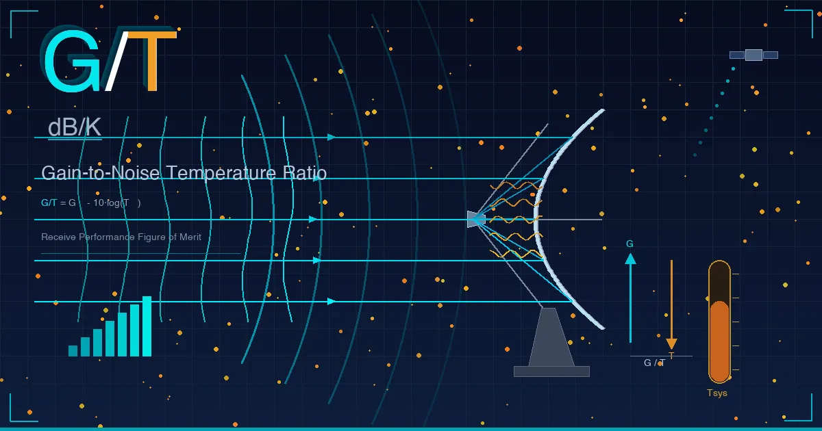
Satellite G/T Explained | Why Antenna Gain-to-Noise Temperature Matters in SATCOM
Engineering guide to satellite G/T covering definition, formula, system noise temperature, receive chain design, VSAT and maritime examples, and comparison with EIRP, antenna gain, and C/N.
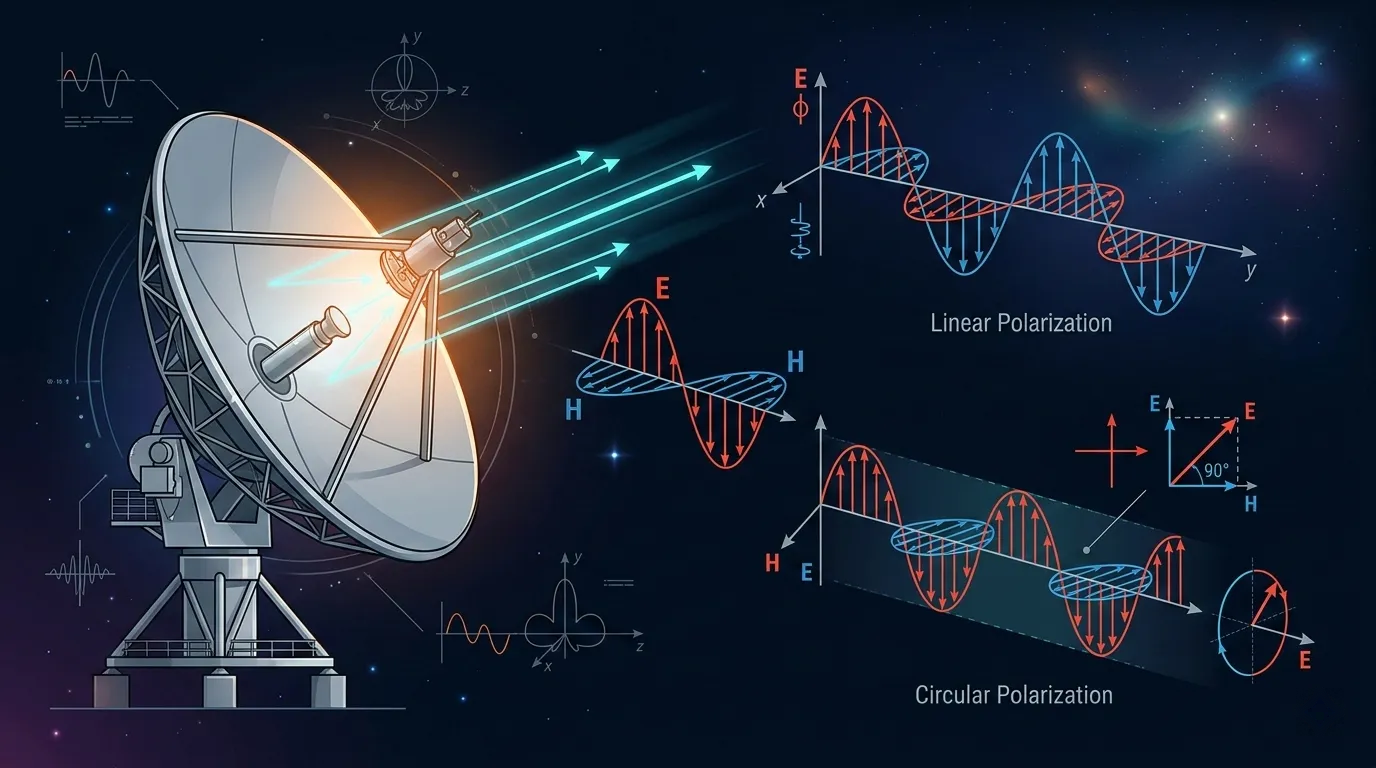
Satellite Polarization Explained: Linear vs Circular Polarization in SATCOM
Engineering guide to satellite polarization covering linear and circular polarization, cross-polarization interference, antenna alignment, polarization reuse in HTS, and Ku/Ka band polarization schemes.
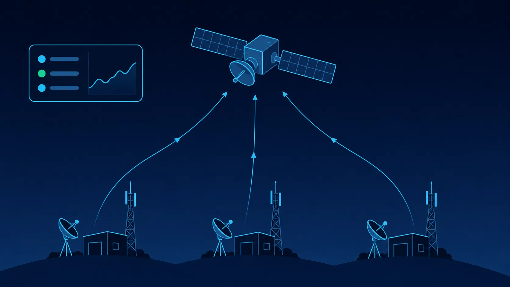
Remote Site Network Monitoring Over Satellite | Practical Operations Guide
Practical guide to monitoring remote sites over satellite — architecture, KPIs, alerting design, troubleshooting, and bandwidth-efficient strategies for NOC teams managing VSAT networks.